
Coron Andringitra sits at the top of a granite massif so rugged it barely registers as Earth. Madagascar, the fourth largest island on the planet, has been geologically isolated long enough that most of its wildlife exists nowhere else. That kind of singularity has consequences for every traveler who shows up: roads are brutal, distances are deceptive, and the rewards are proportional. Zac and Ine of World Wild Hearts spent three weeks crossing the island and returned with a ranked list of ten places that hold up.
From thermal springs to stone forests
The journey through Madagascar’s highland interior begins in Antsirabe, the country’s third largest city, where wide colonial avenues and thermal springs set a slow pace. The classic way to take it in is by pousse-pousse, a human-pulled cart that fits the rhythm of the place. A one-hour drive out of town reaches Lake Tritriva, a volcanic crater lake with a circular hiking trail of roughly the same duration.
Moving west, Morondava sits along the Mozambique Channel as the laid-back gateway to the interior. A traditional pirogue ride to the nearby fishing village of Betania breaks up the beach-town ease with something more grounded: fishermen at work, nets drying, daily coastal life moving at its own pace.
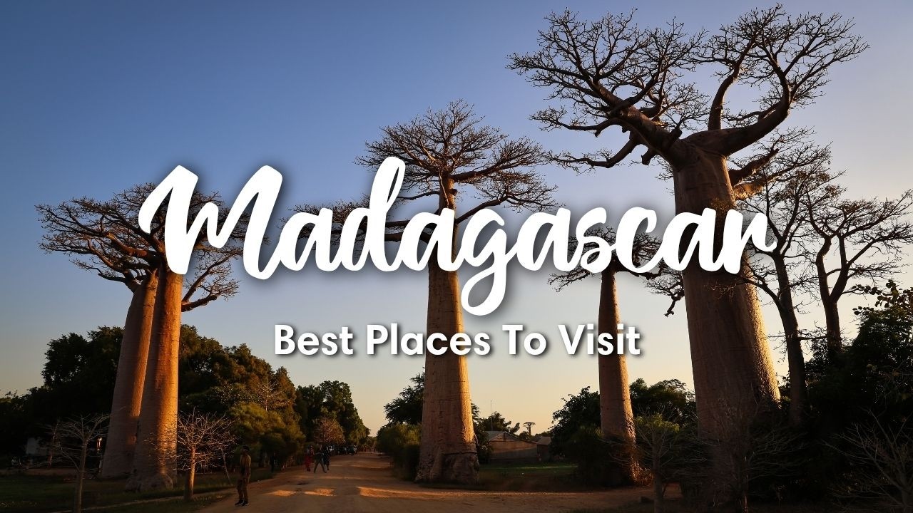
Baobab Avenue, about 20 km east of Morondava, is the country’s most photographed landmark. Of the nine species of baobab found globally, six are endemic to Madagascar, including the towering variety lining this protected stretch of road. They reach roughly 30 meters tall and are all that remain of a once-dense forest. Most visitors arrive at sunset for the golden silhouettes, but Zac and Ine noted that daytime visits are considerably quieter.
Ranomafana National Park brings the misty southeastern highlands into focus. Night walks reveal mouse lemurs and chameleons; day treks surface satanic leaf-tailed geckos and other reptiles. The real highlight came early: ‘We just spotted our first lemurs ever,’ Zac said, ‘the golden bamboo lemur and the greater bamboo lemur just in the trees above us.’
On the southwestern coast, Ifaty handles beach relaxation and coral reef diving. For more solitude, the tracks heading north toward Salary Bay and Andavadoaka require solid driving experience and a dependable 4×4.
The Nosy Be Archipelago, off the northwestern coast, is Madagascar’s most tourist-ready zone, with direct international air connections. The main island is developed but convenient. Nosy Sakatia and the sandbank of Nosy Iranja are the quieter alternatives.
The places that required the most from the body
Isalo National Park in the southwest is the kind of terrain that looks designed: eroded sandstone massifs, oases, deep canyons, and a rock formation called the Isalo Window that frames the sunset without any help from human hands. After a long morning hike, the pair reached the Black Pool and swam in what they described as surprisingly icy water.
Tsingy de Bemaraha, a UNESCO World Heritage Site in the west, divides into two zones. The Small Tsingy pairs well with a river boat tour to nearby caves. The Big Tsingy is the one that earns the designation: navigating it requires a climbing harness to cross suspension bridges and squeeze through narrow crevices above the ground, then descend into lush forest canyons below the limestone pinnacles. Getting there involves long unpaved roads and river crossings that close entirely in wet season.
Andasibe, about 150 km east of the capital Antananarivo, offers the most accessible rainforest experience on the island and is the primary sanctuary for the indri, the largest living lemur species.
The Andringitra Mountains in the southeast came in at the top. Granite massifs, dramatic cliffs, and several peaks above 2,600 meters define a range that rewards multi-day trekkers and day hikers alike. Zac and Ine hiked to the summit of Chameleon Peak, and the panoramic views from the top were the clearest argument for putting it first.
The peak that kept moving
Chameleon Peak in the Andringitra Mountains sits somewhere above 2,600 meters, the exact number unmarked, the summit unmarked on most itineraries.
For three weeks, Zac and Ine pushed through the rough roads that connect every place on this list, arriving finally at granite cathedrals rising from the Tsaranoro Valley below. The stone was the same material that started the whole island: isolated, unrepeatable, and not especially interested in being easy to reach.