Two hours out of Reykjavik, Rick Steves is already standing behind a 200-foot waterfall, rain parka soaked, watching tourists lose their minds over rainbows. That’s the opening promise of Iceland’s south coast – and the ring road, an 800-mile loop that strings together the entire country, delivers on it fast.
From Seljalandsfoss to the black sand beaches near Vík, here’s what the south coast leg actually involves: the waterfalls, the super-Jeep backcountry runs, the geology lesson no one asked for but everyone remembers.
Seljalandsfoss and the Case for Getting Wet
Seljalandsfoss is one of Iceland’s most-visited waterfalls for an obvious reason – there’s a trail that loops behind the cascade. The water drops more than 200 feet off a cliff edge, and on sunny afternoons the mist throws up rainbows that turn ordinary travelers into impromptu photographers. Steves notes the energy behind the falls as ‘palpable,’ which tracks: the slippery path draws a crowd willing to ruin a jacket for the shot.
The south coast’s entire backdrop is a chain of glacier-capped volcanoes sitting on the rift between the North American and Eurasian tectonic plates – two continental masses still slowly pulling apart. That geological tension is the engine behind everything dramatic happening on this island.
Þórsmörk by Super Jeep: Where the Tires Deflate on Command
Deeper into the south coast, the terrain demands different equipment. Steves and crew hire one of Iceland’s ‘super Jeeps’ – enormous trucks fitted with monster tires that deflate at the push of a button for extra grip on glacial river crossings. The destination is Þórsmörk, a remote valley the show describes as ‘one of a kind even in this land of superlatives.’
Normal cars can’t reach it. But the access isn’t purely exclusive – a public bus service also runs into the valley, using the same oversized deflatable tires. Remote lodges dot the area, giving hikers a practical base. The vehicles churn through rivers of glacial melt, and passengers walk away with, as Steves puts it, ‘a tale to tell.’
Back on Highway 1, the ring road keeps producing. Detour signs along each smaller road come with schematic maps – every farm, restaurant, guesthouse, and point of interest marked clearly. Accommodation runs the full range: large hotels, prefab cabins, yurts, remote hostels, and campsites.
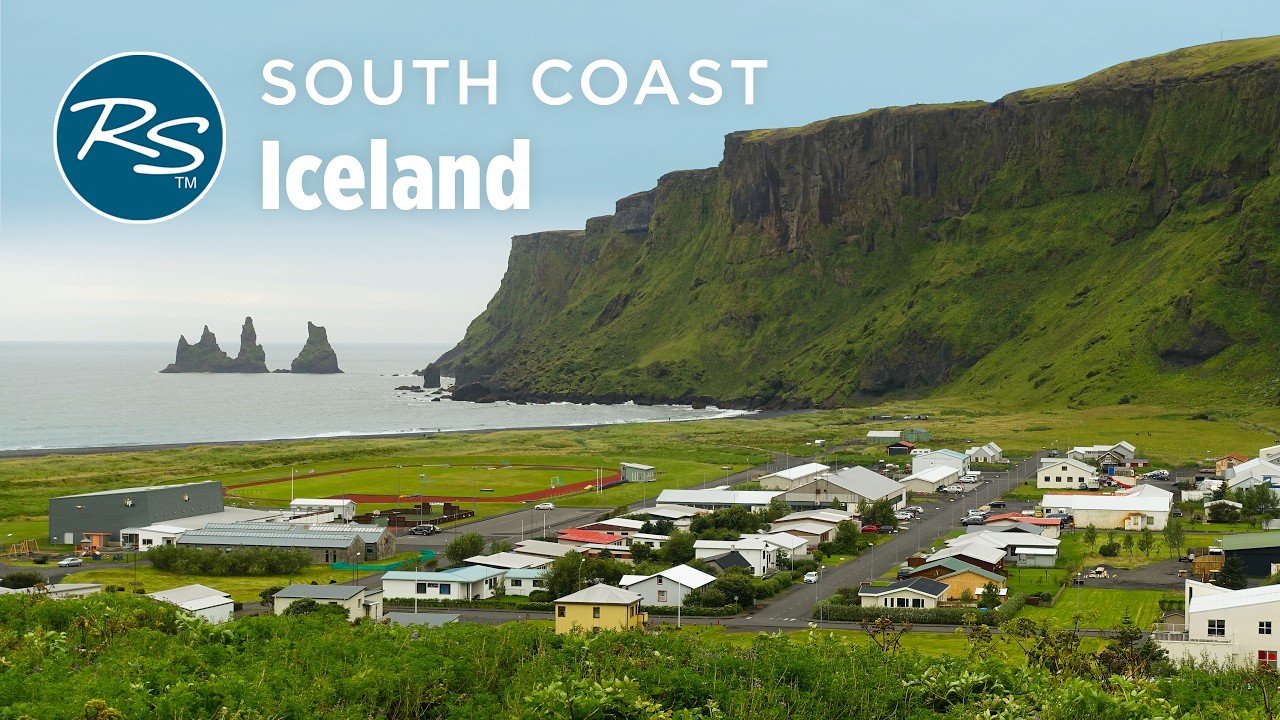
Black Sand, Sea Stacks, and the Village That Never Had a Harbor
From a coastal promontory on a clear day, the entire south coast stretches into view. Below sit black sand beaches – volcanic byproducts that frame basalt sea stacks rising from the Atlantic. Steves describes the basalt formations as bringing ‘out the kid in every adventurer,’ and the windswept walk along the shore is framed as one of the route’s more quietly affecting stops.
The south coast ends at Vík, Iceland’s southernmost village. It’s spare and functional – a practical pit stop, nothing more. Before the ring road existed, Vík had no harbor. A century ago, supply boats simply beached on the black sand shore to unload provisions. The road changed everything.
The Bigger Picture
Iceland’s approach to nature tourism is worth watching. A country of 400,000 people has built an entire infrastructure – super Jeep fleets, backcountry bus routes, schematic roadside maps – around making extreme landscapes accessible without softening them. Visitors still get wet, still hike, still cross glacial rivers. The commercial layer is thin enough that the raw experience survives. That balance is harder to maintain than it looks, and Iceland has managed it across an 800-mile loop.
Steves opened the segment two hours from Reykjavik, already behind a waterfall. By the time the route closes at Vík’s black sand shore, the ring road has made its case – Iceland’s south coast repays the distance with every mile.